The Walker's Haute Route
|
The Walkers Haute Route - | |
|
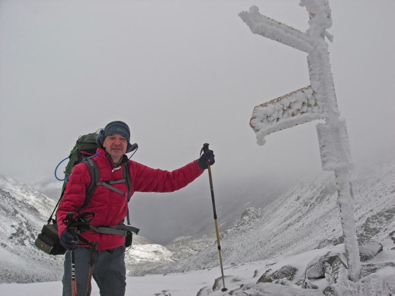
September 3 - Trip members - |
|
|
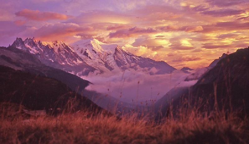
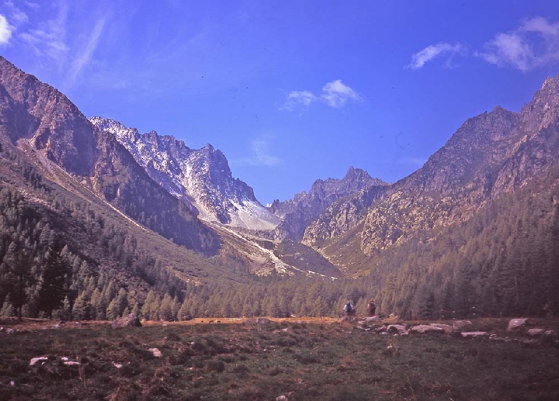
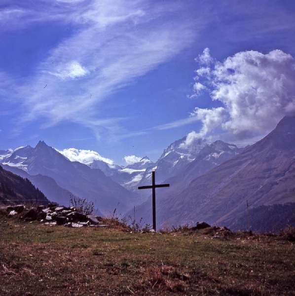
The Walker’s Haute Route runs from Chamonix in France across the Swiss Alps to the town of Zermatt. The route is about 115 miles long and starts with great views of Mont Blanc and finishes with the wonderful scene of the Matterhorn. The trek is of varying heights up to 3000m, and takes about two weeks to complete. The excellent guide, "Chamonix to Zermatt" by Kev Reynolds, was used for the trip and is highly recommended. | |
|
| |
|
Day 1 Chamonix - After an early flight from Luton to Geneva, the Mountain Dropoffs shuttle bus service
got us to Chamonix by early afternoon. Gas cylinders were picked up at the supermarket
in the centre of the town and then it was time to start the trek. The route to Argentierre
was woody with great views up to the Aguille du Midi, the Mer de Glass and the face
of the Dru. The climbing started after Argentierre with the ascent up to Le Tour
and then beyond up towards the Col de Baume. We did not manage to get completely
to the Col before hunger and the desire to get settled for the night kicked in and
we stopped for our first camp of the trip. We had invested in some new sleeping gear
for the trip with Go- |
|
|
Day 2 Col de Baume - The day dawned with fine weather and we packed up the tent ready to be start by about eight in the morning. The climb to the Col was finally finished and we crossed over to Switzerland. We then joined the Alternative Stage 2 route of the guide going towards the Les Grands refuge. We were overtaken by Mark from Israel on this stage who we kept in contact with until the Arolla campsite. The Trient Glacier loomed ever bigger as we made our way towards it and the Chalet du Glacier at its base. After crossing the river outflow from the glacier the long climb towards the Fenetre de Arpette was started. This turned out to be hot slog in the heat of the afternoon. Physically this was the low point of the trip for David who was pretty tired when the summit of the Fenetre was finally reached. The descent down the Val d’Arpette was very rocky and we were very nearly at Arpette Hotel before we managed to find a comfortable place to set up the tent for the night in the forest just above the hotel. |
|
|
Day 3 Campsite near Arpette to Villette The profile in the guide for day 3 looked pretty gentle so we were quite relieved by this thought after the tough previous day. A later start in the morning allowed the tent to dry out before packing and a bed and breakfast stop to be booked in the Champex tourist office for the evening in Villette. The day’s shorter walk was pleasant through agricultural terraces and the town of Sembrancher. The bed and breakfast was reached at about five in the evening and a welcome shower and a good pizza in the square in Le Chable followed swiftly on. |
|
|
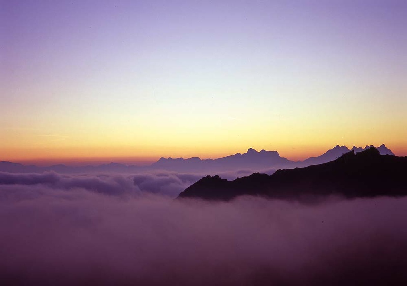
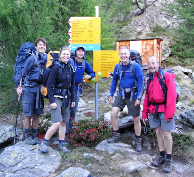
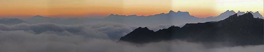
Day 4 Le Chable to Cabane du Mont Fort The ascent above Villette lead to our only navigational error of the trip when we ascended too far up to the village of Medieres before realising our mistake and having to retrace our footsteps to Fontanelle to regain the correct route. Pleasant walking through woods lead upwards to Clambin, were the vista opened out with views across to the Grand Combin. Eventually the Cabane du Mont Fort Hut was reached and the tent set up below the refuge. The evening was marked by two significant events. The first was a most magical sunset with mist nestling below the peaks and the refuge, the second was the massive threatening noises from rock falls on the Sentier des Chamoise path. We were reliable informed by the warden of the refuge that it was too dangerous to cross this path so plans were made to use the alternative route for the next day via the Col de la Chaux. This was the first stop where we met Sean from Harrogate and Alex and Jamie from Beverley who we kept up with for the rest of the trip. |
|
|
Day 5 Cabane du Mont Fort to Ref des Escoulaies The night was cold and the tent was coated with a layer of ice in the morning. Further noises from rock falls during the night confirmed the route decision so we set off to climb the Col de la Chaux. This area is in the throes of large scale ski development so in terms of the quality of the scenery this was probable the low point of the whole trip. The col was reached and the desolate Grand Desert entered. The route was quite busy at this point with a group of English walkers out to complete a much shortened version of the Haute Route in quite a brutal style. The way marks were carefully followed at this point to make sure the easiest way across the rocks was maintained. There was nothing very memorable about this section of the route and we eventually descended to the massive quarry where the Cabane de Prafleuri had been built. A cup of coffee and some plum tart helped us on our way across the Col des Roux, where a herd of Ibex were seen at the col. We finally came to rest for the night at the open Ref des Escoulaies were we spent a very comfortable night in the company of Mark. |
|
|
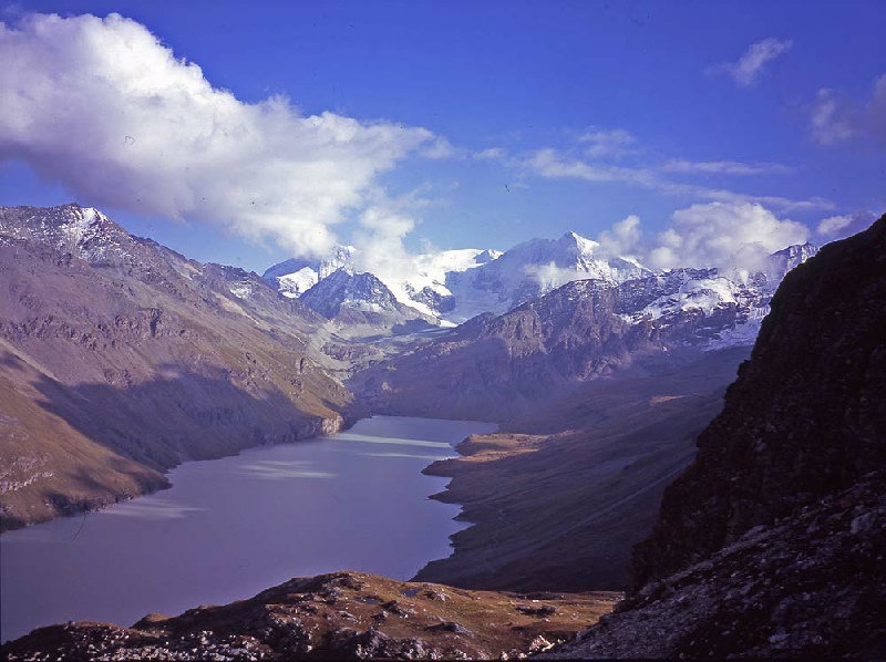
Day 6 Ref des Escoulaies to campsite below Arolla The first port of call of the day was the Refuge la Barma where we caught up with the news of the progress for some of our fellow travellers. The walk by the side of Lac des Dix was pleasant and we were joined on the journey by Christine and her dog Bougie from Sion, just a bit further north. Bougie was having great fun trying to track down marmots along the way. At the far end of the lake the path forked and we started our climb up to the Cabane des Dix. The views of Mont Blanc de Cheilon were astonishing and we stood for some time in awe at its ferocious North Face. After being joined by Sean, we set off to the Cabane where we were just too late to get a coffee. The next stage of the day’s walk involved the uneventful crossing of the Glacier de Cheilon and then the climb up to the foot of the ladders at the Pass de Chevres. Although somewhat intimidating from below, the angle of the ladders was such that the arms did not have to pull too much and even with the weight of rucksack they were quickly scaled successfully. The path to Arolla was quite steep at first but soon flattened out before joining the Col de Riedmatten path. The walk into Arolla was extremely pleasant but we did not manage to get to the shop in the centre of the village before it closed for the afternoon. We decided to spend the night in the campsite so quickly set off to descent to the bottom of the valley to get booked in to the campsite. |
|
|
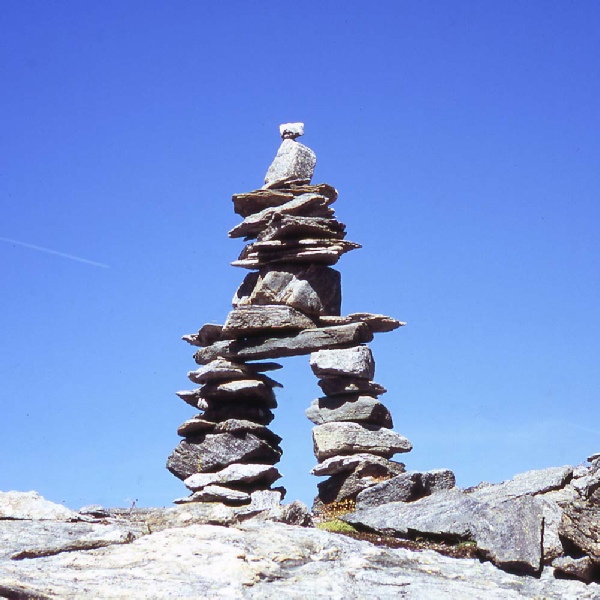
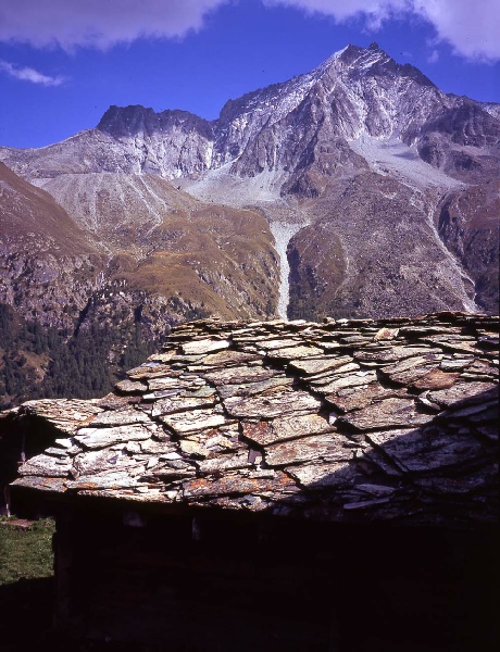
Day 7 Camp site below Arolla to La Sage The route for the day started back in Arolla and involved a little climbing back up to the centre of the village. The chance to book a bed in the dortoir in La Sage for the night was then taken at the tourist office. The route climbed out of Arolla and traversed across the mountain side eventually arriving at the aptly named Lac Bleu. Below the lake, a tiny alp hamlet provided some good photo opportunities with the rustic stone roofs and old timbers. The Val D’Arolla was then followed to the village of Les Hauderes and the final climb up to La Sage. The dortoir was old and full of character and we were made very welcome by our hosts. Highly recommended. |
|
|
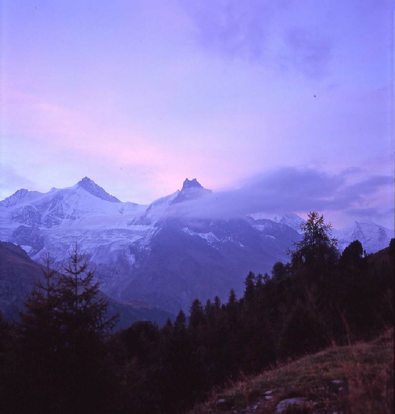
Day 8 La Sage to camp above Zinal A significant climb was expected on the next day up to the Col de Tsate and it turned out to long walk over grass slopes with a short stony section just below the col. The descent lead eventually to the car park below the Moiry glacier and a decision to carry on towards Zinal rather than walk up to the Cabane de Moiry. A fine path lead from the car park upwards and then along high above the Lac de Moiry. At the far end of the lake the footpath to the Col de Sorbois was joined and after more climbing to eventually reach the crest of the Col. The descent towards Zinal was complicated somewhat by ski development building work but we eventually found a wonderful camp spot just above the tree line overlooking the majestic Weisshorn peak. |
|
|
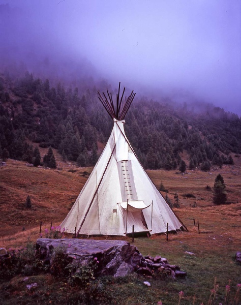
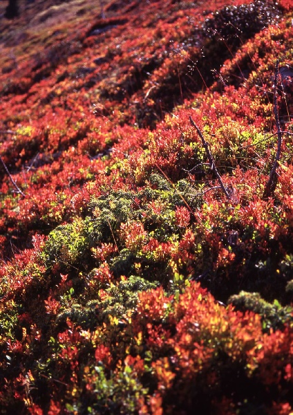
Day 9 Camp above Zinal to Gruben The descent to Zinal was steep and was potentially confrontational after we encountered a sign towards the top of the descent declaring that the path was closed due to tree felling work. We could hear the chainsaws below us but fortunately the work was being carried out below the path so we did not have to negotiate our passage with a bunch of Swiss loggers. Zinal was a good place to stop for a coffee and allowed us to book a place in the Europa hut for our last night on the walk. There are a number of different routes to Gruben from Zinal, including stops at the famous Weisshorn Hotel and the Cabane Bella Tola. We were undecided at the beginning of the day which route we would take but we eventually decided the direct route via the Forcletta pass would suite our needs best in terms of timings. The morning walking was through pleasant pastures and higher up across beds of very beautiful red bilberry bushes to eventually reach the long and easy zigzag path of the Forcletta. The descent to Gruben seemed long and we were joined at this point by Helen from Bristol. Helen had been walking in the area before and told us that there was a possibility of some accommodation in Indian style Tipis just outside Gruben. We saw three such structures on our descent into the village and eventually set up camp inside one of them. They were part of the Gruben Tipi community and we were welcome to use them |
|
|
Day 10 Rest day due to bad weather The rain lashed down on the Tipi during the night and after a short exploratory foray at six in the morning it was pretty clear we were not going anywhere on this day. Still, we had the shelter of the Tipi to protect us from the weather. Helen got her rain gear on and set out into the foul weather but we stayed put for the day. Gruben is very small and a walk into the village was only successful in acquiring a small loaf of bread and a couple of tomatoes from the Hotel “shop”. The Tipi was in fact incredibly cold due to the cold air being drawn under the canvas and out through the smoke vent in the top. In order to protect ourselves from the cold we set up the tent in the middle of the Tipi and so we had a warm and comfortable night in the end. |
|
|
Day 11 Gruben to camp near Gasenreid The weather had cleared during the night so we set off in the morning ready to ascent
the Augsbordpass, the final pass of the Walker Haute Route. We popped into the Scharzhorn
Hotel in Gruben and compared notes without fellow walkers on how they had survived
the rigours of the previous day’s bad weather. Everyone had thankfully safely got
to their desired destinations by various means. Higher up towards the pass we could
see that significant amounts of snow had fallen but the lower slopes were clear and
the visibility was only limited near the top. The initial stage of the day lead us
through spacious woodlands and high pastures to the higher snow covered rocky landscape
of the pass. A small lochan mentioned in the guide book was a critical feature in
managing to keep to the red and white flashes on the rocks even though the path was
obliterated by the snow and eventually we reached the sign at the top of the pass.
The weather here was testing with a biting cold wind, limited visibility and a lot
of ice. We were however joined at this point by a young American man waving his arms
madly and shouting wildly about how beautiful everything was. He was dressed in the
skimpiest of running shorts, wrecked running shoes and most bizarrely was carrying
a guitar strapped to his back. He gesticulated wildly with his i- The descent from the pass was difficult with a thick layer of ice on the path so it was with a great deal of relief when we had descended to the point when the ice started to melt. The descent was marked by the wonderful view point with the Weisshorn expressing its dominance of the region again. The path lead to the hamlet of Jungen and then down and down to finally reach St Niklaus. After a brief stop at the tourist information centre the walk up the steep valley sides to Gasenreid was started. We had hoped to get a meal at the restaurant in Gasenreid but this turned out to be very expensive so it was our final pack of dehydrated curry rice for the meal that night. We camped at the barbeque spot just outside the village and directly on the route ready for the next day. |
|
|
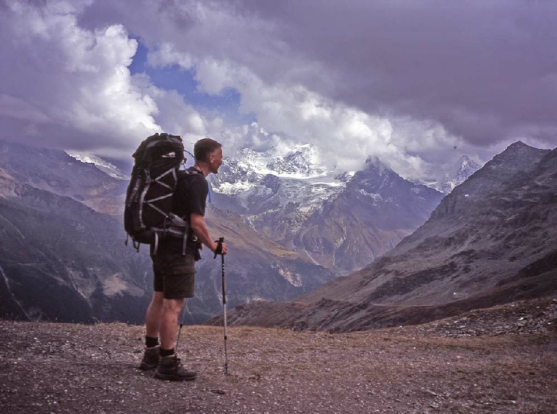
Day 12 Camp near Gasenreid to Europa Hut We had been looking forward to this day for a long time, the day when the Matterhorn would finally reveal itself to us. The route taken was the high mountain Europaweg, below the massive range of 4000m peaks that includes the Dirruhorn, Nadelhorn and the Lenzspitze summits. There were several places with warnings of potentially dangerous stone falls were speedy crossings and care were required. Ropes were also used extensively to safeguard sections of the path. Two hours from Gasenreid the vista widened above the forest and the first of a set of great views were encountered. The chain of the Bernese Alps were the back drop with nearer peaks such Weisshorn the foreground. The path was rocky and we soon reached the very unstable Grosse Graben combe. The way curved around the hillside for a considerable time, crossing glacier streams and eventually through some woods to reach the Europa Hut. This was our first stay in a hut on this trip and we enjoyed the food and company greatly being joined by Sean, Alex and Jamie for our last night of the walk. |
|
|
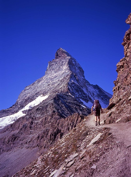
Day 13 Europa Hut to Zermatt Our last day on the walk with the added excitement of reaching Zermatt at the end
of the day. The first part of the day was complicated by the demise of the large
suspension bridge that had been built over the Wildibach torrent. This has now been
closed due to rock damage to the structure of the bridge and it is very unlikely
it will ever be repaired. In order to accommodate this problem, it was necessary
to descent into the valley almost to the valley floor at Randa then climb up again
to re- |
|
|
Useful Information | |
|
Links to Accommodation B and B Claudy- |
|